


Santuck Comm Center, Elmore County, Alabama
About
Outline

Summary
| Unique Area Identifier | 521691 |
| Name | Santuck Comm Center |
| County | Elmore County |
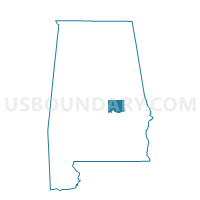
| State | Alabama |
| Area (square miles) | 13.05 |
| Land Area (square miles) | 12.88 |
| Water Area (square miles) | 0.17 |
| % of Land Area | 98.72 |
| % of Water Area | 1.28 |
| Latitude of the Internal Point | 32.65601910 |
| Longtitude of the Internal Point | -86.14935020 |
Maps


Graphs
Select a template below for downloading or customizing gragh for Santuck Comm Center, Elmore County, Alabama


Neighbors
Neighoring Voting District (by Name) Neighboring Voting District on the Map
- Santuck Community Center, Elmore County, AL
- Santuck Community Center, Elmore County, AL
- Seman Fire Station, Elmore County, AL
- Wallsboro Community Center, Elmore County, AL
- Wallsboro Community Center, Elmore County, AL
- Weoka Community Center, Elmore County, AL
- Wetumpka Civic Center, Elmore County, AL
Top 10 Neighboring County Subdivision (by Population) Neighboring County Subdivision on the Map
- Wetumpka CCD, Elmore County, AL (23,124)
- Eclectic CCD, Elmore County, AL (7,159)
- Titus CCD, Elmore County, AL (4,757)
Top 10 Neighboring Unified School District (by Population) Neighboring Unified School District on the Map
Top 10 Neighboring State Legislative District Lower Chamber (by Population) Neighboring State Legislative District Lower Chamber on the Map
Top 10 Neighboring State Legislative District Upper Chamber (by Population) Neighboring State Legislative District Upper Chamber on the Map
Top 10 Neighboring 111th Congressional District (by Population) Neighboring 111th Congressional District on the Map
Top 10 Neighboring Census Tract (by Population) Neighboring Census Tract on the Map
- Census Tract 306, Elmore County, AL (7,405)
- Census Tract 302, Elmore County, AL (4,757)
- Census Tract 305, Elmore County, AL (4,695)